See Photos Of The Flooding In Midland, Michigan From Space
On Tuesday, May 19th, two dams near Midland, Michigan failed, causing catastrophic damage to the region. The dams broke after several days of rain and completely flooded the surrounding area.
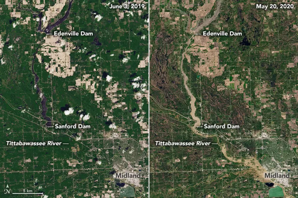
Both the Edenville Dam and the Sanford Dam burst up stream from Midland and flooded much of the surrounding area. You can see what the effects were in satellite imagery of the area from this time last year and from one day after the dam breaches.
The photos were compiled by Joshua Stevens using Landsat data from the U.S. Geological Survey and posted to NASA Earth Observatory.
Photo from June 3, 2019
This photo was taken a little less than a year ago during normal water level conditions in 2019. You can check out a higher resolution version of this photo on NASA Earth Observatory.
Photo from May 20, 2020
This photo was taken one day after the dams burst when water levels were 10 feet above flood levels. You can check out a higher resolution version of this photo on NASA Earth Observatory.
The Midland area disaster was heartbreaking, but Michiganders are coming together to help the flood victims.
Signs of Hope Around West Michigan
More From 98.7 WFGR