Watch Arcus Storm Clouds Rise Up Over Lake Michigan
Tuesday night's huge storm brought with it dark, menacing clouds, which rose up suddenly.
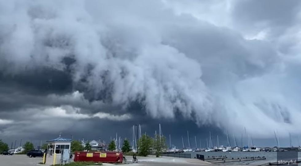
Arcus, or shelf clouds roll up usually at the front of storm clouds or Cumulonimbus clouds. They can also be known as roll clouds. While they look menacing, they are not what bring the damaging winds, but are usually a harbinger of such storms, and can be an indicator of high winds or derechos.
Tuesday's storm system was not as intense here as it was across the other side of Lake Michigan.
These storms, while bringing us massive gusts of winds, never really brought the damage of last week's storm, even though, at times they put on a better show.
A case in point is this video, shot by woman in Milwaukee, Wisconsin, Sophia Ahmad, on the front side of a series of storm cells that moved across Lake Michigan in the late afternoon hours on Tuesday.
A severe thunderstorm warning was issued for areas along the Wisconsin-Illinois border at the time as well as a special marine warning for part of Lake Michigan.
Further east along the storm front, another alert weather watcher caught similar clouds rolling up along an inland lake near Hell, Michigan.
A storm over Hell? It's got to be good, right?
These storms did little to relieve the heat and probably helped jack up the humidity the last couple of days. Heat warnings will continue today throughout West Michigan, with the heat indices hitting close to 100 degrees. We may get a little relief in the form of some thunderstorms Friday, before the heat returns on Saturday. There looks to be a slight cooling trend early next week.
15 Michigan Towns Everyone Should Visit At Least Once
More From 98.7 WFGR


![How Well Do You Know Michigan? [Quiz]](http://townsquare.media/site/43/files/2020/02/Pure-Michigan-Sign.jpg?w=980&q=75)